National Barriers Programme

River fragmentation is the breaking up of a river’s continual flow from source to the sea. It is one of the greatest global threats to freshwater ecosystems because it interrupts fish migration, blocks the movement of fish and other animals within the channel, alters the flow of sediment throughout the channel, affects habitat diversity and impacts overall biodiversity.
Irish rivers are heavily fragmented by weirs, dams, sluices, culverts, bridges and other artificial barriers. The impact of these structures can be broken down into two broad categories:
- Obstructing to fish migration
- Habitat damage
The National Barriers Programme deals with issues related to barriers and works to reduce their impact, within the context of the Water Framework Directive. There are five main aims of this programme:
- Developing a barriers assessment tool
- Barrier surveys and risk assessment
- Creating a national barriers database
- Focusing our efforts
- Guidance for planning and construction

Diagram of the effects of barriers on rivers and fish movements.
Developing a barriers assessment tool
For primary assessment, Inland Fisheries Ireland has developed the I-BAST (IFI Barrier Assessment and Screening Tool) application as an initial screening and barriers assessment tool. This portable data collection application captures information such as barrier location, barrier type, structural dimensions and images. This assessment has been developed to assist in the assessment of instream structures, with the aim of improving fish passage on the island of Ireland. A secondary, more intensive survey may be done subsequently to advise on potential mitigation measures.
Example of a culvert.
A structure that allows a river to flow through or under an obstruction, such as bridges.
Example of a dam.
A barrier that blocks the flow of a river and raises the water level, forming a reservoir.
Example of a ford.
A structure that creates a shallow place for crossing a river by vehicle or on foot.

Example of a sluice.
A movable barrier that can be opened or closed to regulate the flow and water level of a river.
Example of a weir.
An instream structure to regulate flow and water levels, to trap sediment or to reduce the slope of the river channel. Weirs usually allow water to flow freely over the top.
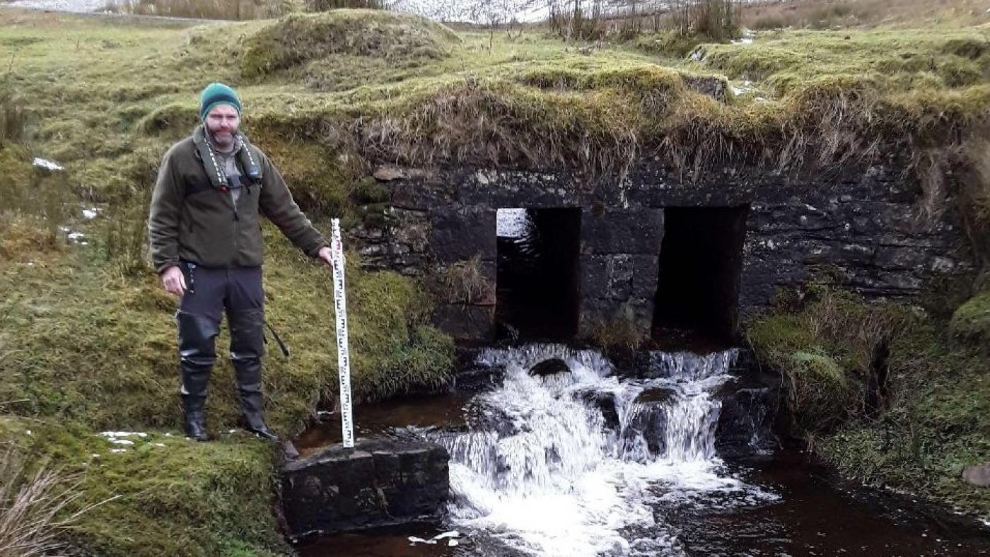
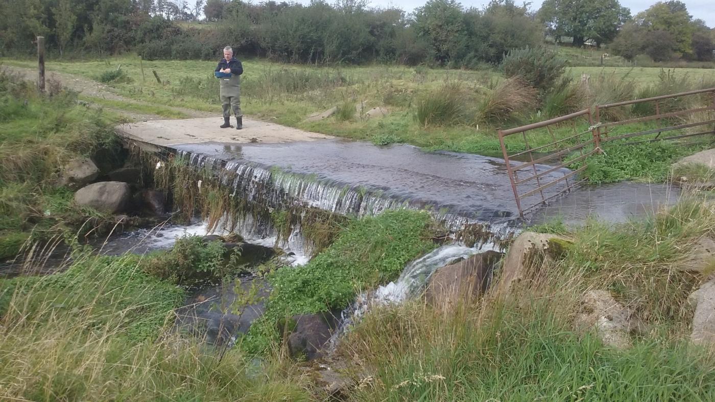
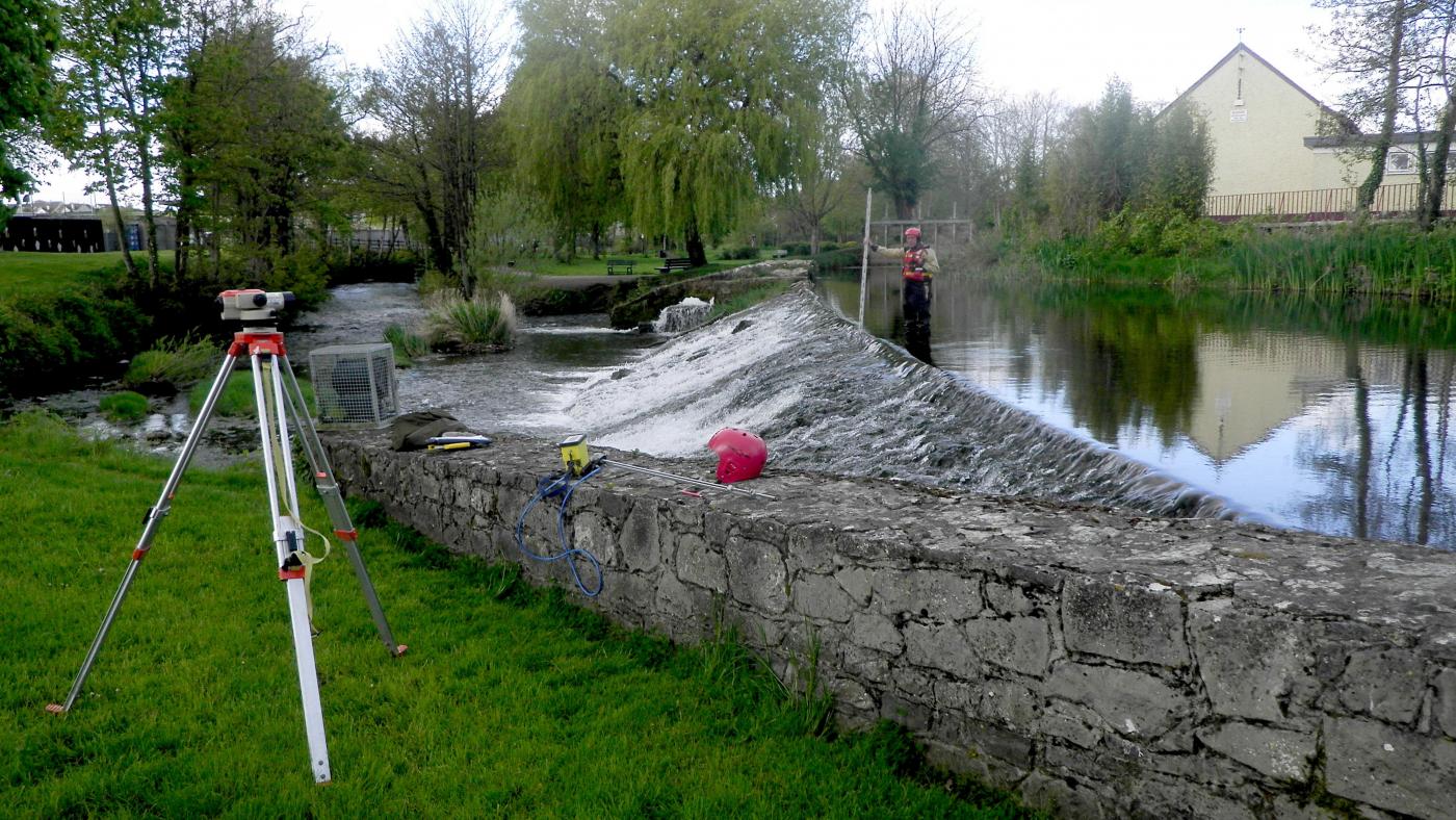
Barrier surveys and risk assessment
To date, we have surveyed almost 22,600 structures using the I-BAST assessment and a further 175 structures using the secondary assessment. Inland Fisheries Ireland has also been joined by colleagues in the Local Authority Waters Programme (LAWPRO), a number of whom we have trained to help record barriers, which further adds information to our national database.

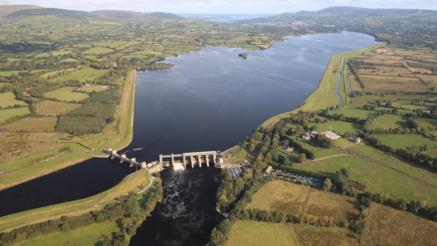
Surveying Askeaton Weir on the River Deel.

Barrier survey of weir at St. Mullins on the River Barrow.

Barrier survey of an impassable bridge apron.
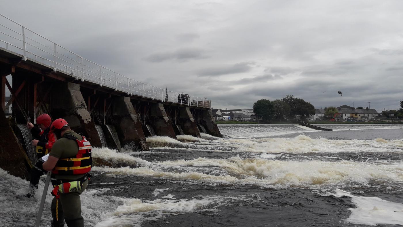
Barrier survey of Athlone Weir on the River Shannon.
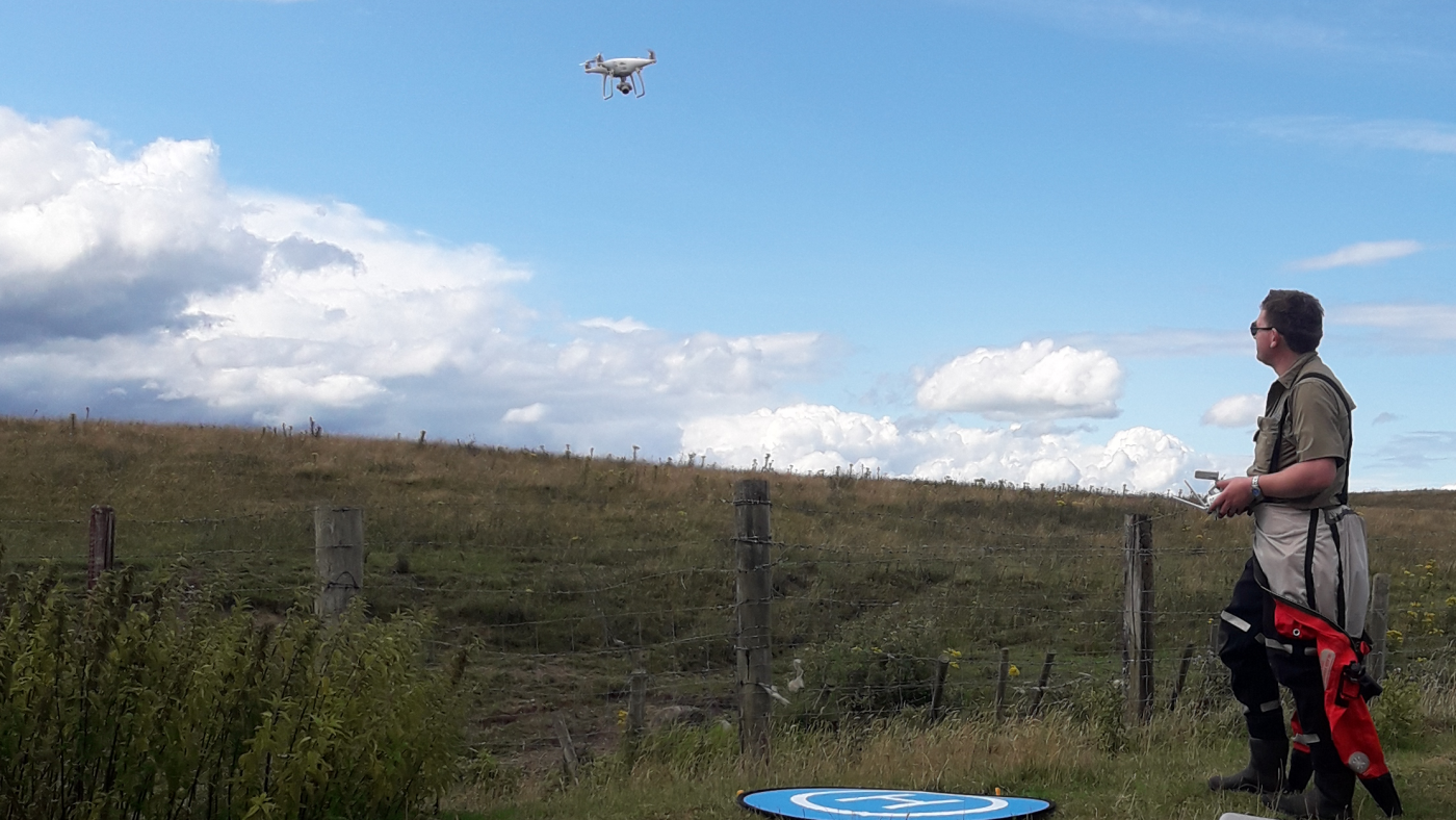
Survey drone used for aerial imagery in the National Barriers Programme.
Creating a national barriers database
Thanks to other national organisations, who have given us lots of data, we have been able to use desk-based techniques to add to our list of potential barriers around Ireland. This supplements our on-the-ground surveys and has increased our total to 73,376 potential barriers on the Irish river network.

Focusing our efforts
Identifying barriers is only the first step, after which mitigation measures may be necessary. Naturally, this can be an expensive endeavour, and some should take priority over others. Prioritisation incorporates many factors, such as amenity value, requirements for compliance with EU Directives, cost-benefit analysis and fish migration benefits.

Guidance for planning and construction
The National Barriers Programme will produce guidance documents that may be used by various stages of the planning, construction and mitigation processes to advise them on best practices and help them comply with legislation.
This project is being done by Inland Fisheries Ireland under the direction of the Department of Housing, Planning, Community and Local Government, with assistance from colleagues in various Catchment Flood Risk Assessment & Management (CFRAM) groups, Irish Rail, Local Authorities Waters Programme (LAWPRO), Office of Public Works (OPW), Ordnance Survey Ireland (OSI), Transport Infrastructure Ireland (TII) and Waterways Ireland.
Webinar: Introduction to the National Barrier Mitigation Programme

Questions & Answers, relevant to the National Barrier Mitigation Programme webinar
Question 1: When is the next funding call likely to come out?
Answer: September 2026
Question 2: How are you managing the H&S requirements i.e. PSDS/PSCS?
Answer: We have a framework of consultants, who have demonstrated competence in this area and as part of our public procurement process using standard CWMF approach, we ensure that the correct appointments are made.
Question 3: Would there be value in having Industrial Conservationists on the National Team? How much is this an issue?
Answer: Industrial heritage is a constraint for certain barriers we would generally specify these studies as part of the specialist consultants contracts.
Question 4: Are you or 3rd parties undertaking any post mitigation monitoring to assess benefits - hymo?
Answer: IFI will be looking at a certain subset of the mitigations and will be evaluating the efficacy of the interventions for a period after completion. The details of this are still being worked out.
Question 5: Do you have any plans for Ardnacrusha?
Answer: There is a separate project being led by the DHLGH that is looking at a Roadmap to Mitigate the Impact of Barriers to Multi-Species Fish Migration in the Lower Shannon Cathcment. The BMD is not directly involved in this project. There are some details available online.
Question 6: Considering the upcoming WFD changes and the obligations under the NRL how are you determining effectiveness of any actions?
Answer: There will be post implemention monitoring of effectiveness on a certain representative subset of mitigation projects. The details haven’t been fully fleshed out yet?
Question 7: Many of the barriers assessed to date have been small, is this representative of the majority of barriers in the country or has there been a focus on small barriers at the start of the programme with a view to look at medium/large-scale projects in future years?
Answer: We have a target of 257 barriers within which we have cartian targets for small, medium and large barriers. Small are the most frequent but the overall proportions may change as we learn lessons from implmentation.
Question 8: Does the selection of sites and the monitoring of the impact of mitigation account for species composition and age composition?
Answer: We do look at species composition as part of planning for mitigation. We try to adopt a multi-species appoach to mitigation wherever practicable. Age is accounted for by considering both upstream and downstream migrations for relevant species e.g. smolts down, adult salmon up etc.
Question 9: Where can we find more details on your plans for the Liffey, Boyne and Suir rivers? As the barrier removal will affect participation? In paddle sport?
Answer: The Liffey weirs project is being run by Fingal County Council. The plans for the Boyne and Suir Rivers are evolving but you can consult the IFI webmaps or contact the barriers team at barriers@fisheriesireland.ie
Question 10: Could your procurement team please consider bundling up a number of barrier projects and letting them out as a bundle to the consultants on your framework, rather than drip feeding them out as at present? This month alone you've sent out 4 all with very short deadlines for submission. Could you rather allocate projects to different consultancies already qualified under the framework?
Answer: Bundling of several barriers into single projects for procurement purposes will be our stratgey going forward.
Question 11: Can the link be shared for the map showing these projects and details of these projects?
Answer: Details of our projects can be found at https://opendata-ifigeo.hub.arcgis.com/apps/f9322c21d8124cc7aa54375901e6b967/explore
Question 12: It would be good to develop a guidance note on weir removal and its impacts (or lack of it) in terms of water quality on the downstream catchment.....it would be a difference between an AA screening or a full AA and associated planning process.
Answer: We will look into this.
Question 13: Would the Barrier Team look at creating a procurement framework of Consultants for the design of barrier improvement that 3rd party agencies can use?
Answer: We will look into this.
Question 14: Are you taking into account any risks associated with invasive species? For example any alignment with Ireland's invasive species action plans.
Answer: Yes, we specify the need for invasive species surveys as part of our scope for consultancy services. The specifics of this are dealt with on a project by project basis at present.
Question 15: Is there a map available that identifies which barriers are subject to removal for each phase?
Answer: Details of our projects can be found at https://opendata-ifigeo.hub.arcgis.com/apps/f9322c21d8124cc7aa54375901e6b967/explore
